2008 IEEE Intelligent Vehicles Symposium
Eindhoven University of Technology, The Netherlands
4-6 June 2008
http://www.iv2008.utwente.nl/
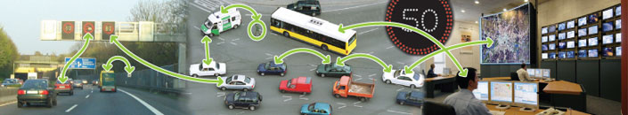
The objective of the 2008 IEEE Intelligent Vehicles Symposium (IV08), which is an annual forum sponsored by the IEEE Intelligent Transport Systems Society, is to encourage knowledge sharing about research and applications for Intelligent Vehicles and Intelligent Transport. The Intelligent Vehicles Conference gathers researchers from industry, universities and public authorities to discuss research and applications for intelligent vehicles, including the communication between vehicles and between vehicles and infrastructure.
Eindhoven (and its region) is known as key area of the Dutch High Tech Industry, including the Dutch automotive industry that consists of over 200 companies. A range of Dutch automotive companies belong to the world top ranking companies. Live demonstrations are expected to be provided by various research groups from Europe.
On June 3, meetings and workshops in conjunction to the conference will be held. On June 6, the road right next to the conference venue will be closed for normal traffic in order to provide a perfect site for demonstrations of intelligent vehicles:
Participation of CVIS
- Paper: "Cooperative Infrastructure" by CVIS partner Peek Traffic BV
Abstract: Generally, vehicles arriving at a controlled intersection all get the same treatment, and often that means they have to stop, wait and accelerate again. When a heavy loaded truck arrives and stops this means loss of green time, extra delay for the vehicles behind the truck and additional emissions, noise and damage to the road surface. Authorities are not only challenged by ever increasing traffic volumes, but also by more stringent environmental targets. One of the aims of the European Commission sponsored research project CVIS (Cooperative Vehicle Infrastructure Systems) is to improve traffic efficiency by means of vehicle-to-vehicle and vehicle-toinfrastructure communication. This paper presents the CVIS technology and a real-life example of its application: the Priority Application. This application can grant priority to specific vehicle types and inform drivers about the expected green intervals. In comparison to the state-of-the-art technology, especially heavy trucks benefit as the Priority Application allows the driver to anticipate an upcoming green light without the need to stop. At the same time this will lower emissions and noise at the intersection.
- Demo "Characterization of the confidence in the map matching process of a localization system"
Map-matching (MM) is a data association problem which consists in selecting the most likely road that corresponds to the current position of the mobile. MM integrity can be monitored using normalized residuals or innovations between candidate segments and the current estimated pose (position and heading). Unfortunately, as a result of inaccuracies in the map or because of large estimation errors, map-matching often has several solutions, i.e. several segments are declared candidates with good integrity. These segments can belong to the same road or to different roads (ambiguous situation). To solve this problem, we illustrate in this demo a multi-hypothesis road tracking method that attempts to exploit data pertaining to road-connectedness. This approach belongs to the class of dynamic state observers, and therefore makes use of multisensor fusion capabilities. Consequently, a NIS (Normalized Innovation Squared) can be computed for each hypothesis, so that integrity may be monitored. In order to handle GPS outages, we first fuse GPS data with proprioceptive sensors (a
gyrometer and an odometer) using an Extended Kalman Filter. This fused pose is then used to compute the NIS of each hypothesis. A second problem is the management of the hypotheses, since multi-hypothesis tracking is a strategy that potentially combines each hypothesis with all of the others, which theoretically leads to an exponential growth in the number of hypotheses. To deal with this problem, we present a new method that makes use of road connectedness for the management of the hypotheses.
NOTE: technical explanation in relation to be found in paper "Road Tracking for Multi-Hypothesis Localization on Navigable Maps" submitted by CVIS partner CNRS.
Website last modified: 20 September 2010
|