POSITIONING, MAPS & LOCAL REFERENCING
In order to support the advanced applications proposed in CVIS, there is a need to develop novel positioning and mapping solutions. POMA intends to develop those new solutions while taking advantage of new communication and cooperation schemas offered by CVIS.
Objectives
Within the CVIS Integrated Project, the POMA subproject will research, develop, test and validate advanced mapping and positioning solutions. POMA is to provide a set of positioning and mapping services that will run across CVIS entities (vehicle, roadside equipment, service center, etc.).
Furthermore, POMA will integrate different positioning techniques, including infrastructure-based positioning, and provide integrity indicators on resulting positions. Regarding mapping, POMA will include new map content, support the distribution and integration of map updates, and support sharing of geo-referenced content across CVIS entities.
Challenges
POMA focuses on the following challenges:
- Going beyond current solutions in positioning and mapping
- Providing cost-effective and reliable positioning solutions
- Integrating on-board sensors and in-road sensors
- Enhancing current map solutions
- Providing framework to create micro-level, highly dynamic, traffic maps
- Formulating confidence levels of the measures
- Transmitting data efficiently to minimize network loading
- Implementing POMA interface within CVIS applications (CURB, CINT, CFF, COMO)
- Implementing POMA solutions in existing vehicle or roadside environment.
Results
There are numerous results expected from POMA within the CVIS project and the external community.
- POMA positioning modules ready for implementation in the vehicle or at the roadside level
- POMA mapping and map matching solutions ready for implementation by CVIS applications
- Interface to exchange geo-referenced content
- Provision of POMA for CVIS applications' test sites
- Contribution to standardization in the field of mapping and positioning
Technologies and key concepts
Key technologies addressed by POMA are:
- Positioning modules integrating different technologies (GPS, EGNOS, inertial sensors, RF signal triangulation, etc.)
- Indicator of overall integrity/robustness (providing error range and level of confidence) to describe resulting pose (position and heading)
- Map modules offering enhanced map content, map access APIs and map update mechanism
- Enhanced map-matching solutions able to compute lateral distance to the centre of the road
- Basic technologies like location referencing, based on AGORA-C, and geo-referencing language for data exchange between the different CVIS entities

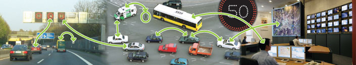
(click on the image)
Events and Milestones
POMA contributes to a series of requirements, specifications, implementations, tests and validations over its 48-month lifespan starting in February 2006. The table below shows the different milestones at the IP level in which POMA will directly contribute.
| M.CVIS.4 |
Consolidated system requirements |
| M.CVIS.8 |
Architecture and system specifications |
| M.CVIS.10 |
Validation plan |
| M.CVIS.12 |
Alpha tested components (core technology, non-CALM) |
| M.CVIS.13 |
Beta-tested core technology components |
| M.CVIS.14 |
Gamma-tested integrated prototypes (with application components) |
| M.CVIS.15 |
Test bed description |
| M.CVIS.16 |
Field trial site integration completed |
| M.CVIS.17 |
Field trial site data collection completed |
| M.CVIS.18 |
Validation results |
| M.CVIS.19 |
Validation workshop |
| M.CVIS.20 |
Final system requirements |
| M.CVIS.21 |
Final architecture and system specifications |
Contact
Katia Demaseure
POMA Sub-project Leader
NAVTEQ
E-mail: katia.demaseure@navteq.com
Sub-Project Partners
|